Project Lifecycle:
Satellite Monitoring to Track Threats and Sustainability
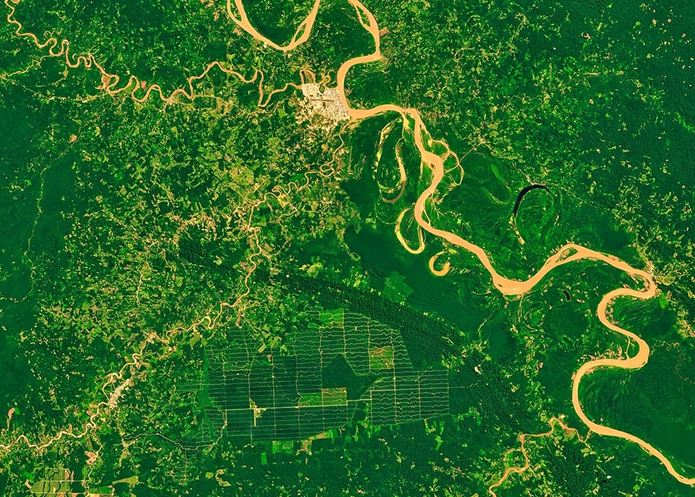
At Rainforest Trust, we work to protect the world’s most threatened tropical habitats to slow climate change, safeguard vulnerable species, and prevent extinctions. To ensure these acres remain protected for the long term, our conservation team relies on satellite imagery, geospatial technology, and custom software platforms to track threats and identify changes in forest cover.
Below, we take a look at how we use technology to monitor for real-time threats and long-term changes in forest cover.
Identifying Emergent Threats with Real-time Monitoring
Chainsaws, fires, and other threats can cut through landscapes with alarming speed. To keep pace with potential threats, our conservation team uses a custom, GIS-supported software platform to identify and compile any current fire or deforestation alerts that might impact active or completed Rainforest Trust project sites. These alerts are then shared with our project lead(s) for any affected project(s).
Once an alert is received, the project lead will assess multiple before-and-after satellite images from various sources to get a better idea of what is happening at the project site. Sometimes, this visual inspection is all that is needed to determine the alert is not a cause for concern—for example, instances of tree loss caused by natural events, small wildfires occurring during the normal fire season in fire-adapted habitats, and expected changes related to planned management practices, such as the removal of some trees for use by local or Indigenous communities living within the protected area.
Other times, however, the satellite imagery might show a clear reason for concern or provide insufficient detail to properly assess the threat. When this happens, the Rainforest Trust project lead contacts the partner to discuss the observed threat, assess whether action is required, and determine whether our support will be necessary. For example, we may provide rapid assistance through our Sustainability Action Fund (SAF) to support fire-fighting efforts or expand anti-poaching patrols.
Measuring Our Impact with Long-term Monitoring
As of September 2025, Rainforest Trust projects have protected more than 58.3 million acres of tropical and subtropical habitat around the world, with another 79.7 million acres in the process of being protected. Combined, these 138 million acres safeguard 3,402 threatened species, store more than 19.8 gigatonnes of CO2 equivalents, and support an estimated 92 billion trees.
Most important of all: we know these protections stand the test of time. Almost 99% of the forests we’ve protected since our founding in 1988 remain standing today. As long as these acres remain protected, they will continue to help prevent extinctions, slow climate change, and maintain a healthy planet for us all.
Our Science & Monitoring Team calculates this “standing trees” metric every year. To do so, they rely on the annual tree cover loss dataset published by the Global Land Analysis and Discovery Lab at the University of Maryland and Global Forest Watch, which uses satellite imagery to detect annual tree cover loss at a resolution of 30 meters. By comparing the current forest cover with data from the time of protection, our Science & Monitoring Teams can calculate the amount of forest loss at each protected area and for all completed Rainforest Trust projects combined.
Although the number varies slightly from year to year—often due to the addition of new projects and protected areas—we consistently find 98-99% of forests at our project sites remain standing once protections are complete.
Conservation work at Rainforest Trust and elsewhere relies on a number of terms that may be unfamiliar to many readers. These terms are shown with bold text in the article, and are defined here.
Partner; Partner Organization
The partner or partner organization is the organization that submits the concept note and application to Rainforest Trust. Partner can also refer to the primary contact at the applicant organization.
Project Lead
The project lead is the individual staff member on the Conservation Department’s Programs Team who is responsible for managing the progress for a specific accepted project. Rainforest Trust has several project leads on staff, each of whom specializes in one of our three primary regions of focus: the tropical and subtropical regions of (1) Africa, (2) Latin America and the Caribbean, and (3) Asia and the Pacific.
Science & Monitoring Team
The Rainforest Trust Conservation Department has three separate teams: Strategy, Programs, and Science & Monitoring. The Science & Monitoring Team harnesses the best available scientific data, analyses, technology, and advances in conservation science to support, improve, and monitor the conservation impact of Rainforest Trust’s work.
The Latest

Sign up to receive the latest updates
"*" indicates required fields

